~469km (~3675km total)

The northern terminus on this map should say “Dawson City,” but Google Maps, in its infinite wisdom, decided that, because the Top of the World Highway is now inaccessible from Alaska (closed for the season), it will not connect communities on either side of this highway, yet still allow travel along its entire length. I’d take Google Maps road data in northern North America with a large grain of salt at this time of year.
August 17, 2014
Beaver Creek – Lakeview Campground, ~86km
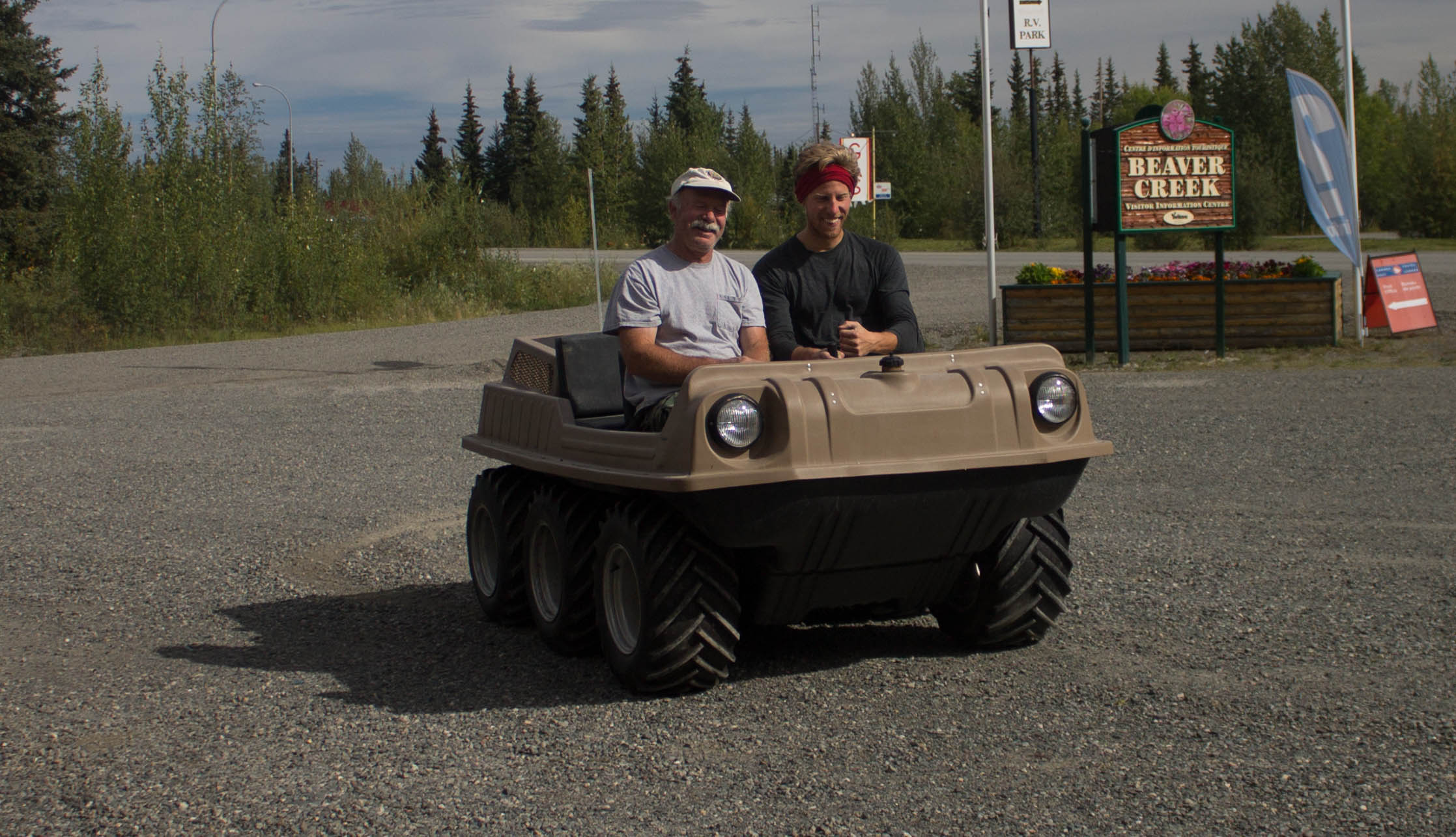
After a longer sleep than anyone has any right to, I headed down to the hotel office for complimentary coffee. Bob and Karen, my culinary benefactors from the previous evening, were there visiting with the staff, and they had prepared a gift basket for me, which included several freeze dried meals. As if they were not content with the heaps of generosity they were already sending my way, they then took me off on a tour of a local museum-in-progress, curated by a Sid, whom I had met the previous day at the Beaver Creek Visitor’s Centre. He had converted his garage into a cornucopia of Alaskan and Yukon memorabilia, including several antique cars, left over from the Alaska Highway construction and the Chisana Gold Rush.
Sexacycle touring?

Sid’s Museum

Old tobacco tins.

Posing with the RCMP. It’s hard to look too serious with one pant leg shoved into a sock.

Old wagon wheels.

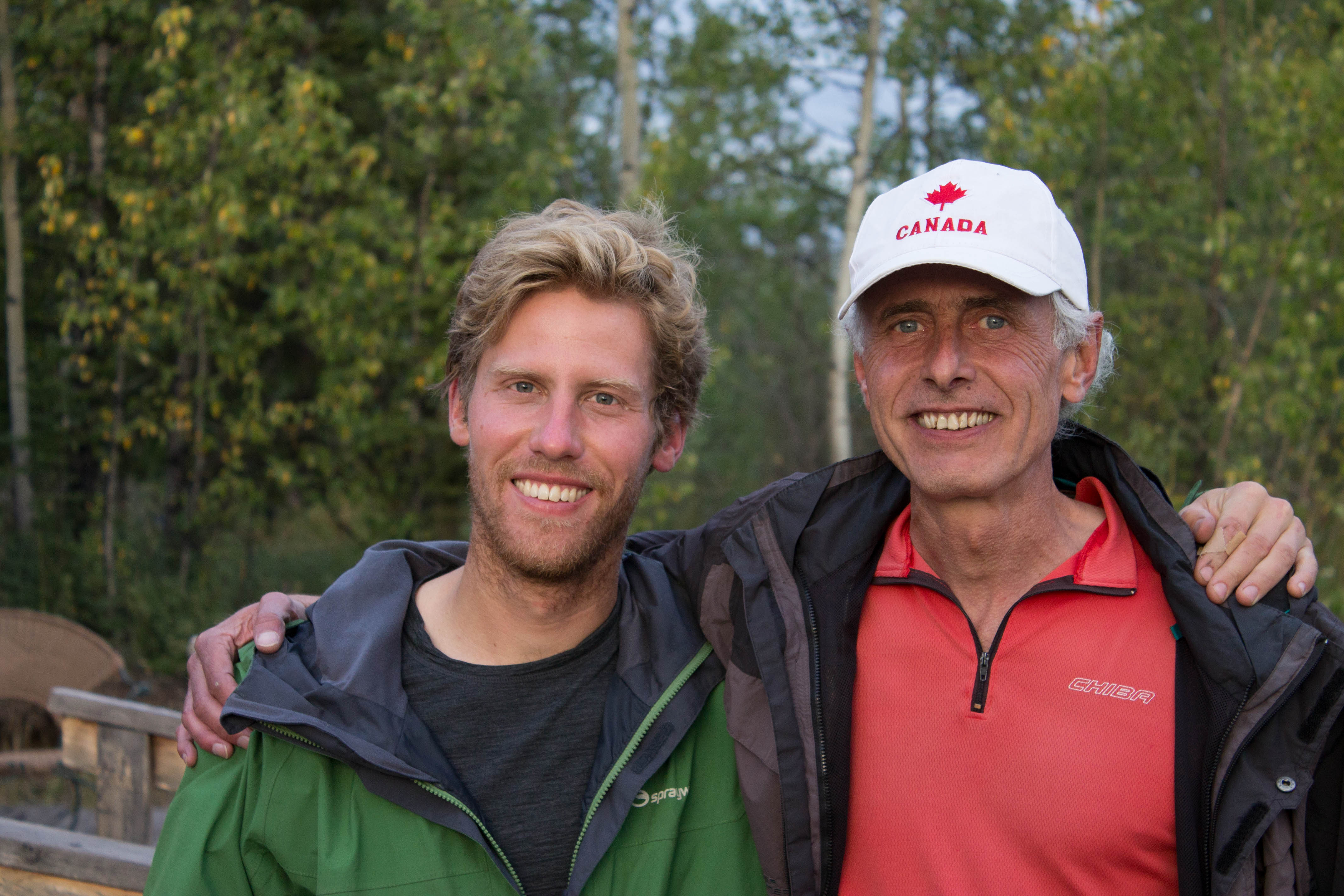
Bob and Karen (and me), fast friends in Beaver Creek.
I left Beaver Creek around 1:30pm after a heartfelt goodbye. The road towards the Alaskan border at the 141st meridian was flat and boring, but I could see distant thunderstorms – two of them – closing in. They reminded me of those I had frequently come across while crossing the prairies the previous summer, those milky blue-gray voids perched uneasily on the horizon.
The sum total of their fury amounted to a few drips across my back as I arrived at the border to Alaska. At first glance, the 60ft wide clearing of trees that extends seemingly indefinitely to the north and south, marking the 141st meridian and the border between the USA and Canada, might seem needless, even reckless. However, when compared to the often contentious north/south border that “generally” runs along the 49th parallel, this one is quite inoffensive, feeling like more of a north-south connection than a east-west restriction. The International Boundary Commission governs the maintenance of the clearing, and it is spruced up every 25 years, a process shared by Canadians and Americans. There are no plans to put a fence along the clearing, owing largely to the fact that wild animals don’t generally have citizenship (or, at least, they don’t honour it).

Staring south down the 141st Meridian.
One thing that did immediately change when I crossed into Alaska was the highway surface. The chipseal immediately became glorious, buttery-smooth asphalt, and it remained so for the rest of the day. After a mid-afternoon beer at a border shop, I rode on into the Tetlin Wildlife Reserve.

On the left, Yukon chipseal. On the right, Alaskan asphalt.
For the last 46km of the ride, I felt like I was perpetually climbing, which surely wasn’t the case, given that Beaver Creek and Lakeview Campground were at nearly the same elevation. The road wound through the wilderness like an errant seam on a large quilt, with nearby hills gently protruding into pleasing, symmetrical shapes. The view to the right of the road was generally obscured by these hills, but, to the left, they occasionally parted to reveal a massive, rolling valley that terminated far south at the Alaska Mountain Range.

Smooth Highway heading west along the Alaska Highway.
Just before I arrived at the campground, a massive black bear casually ambled across the road about 30ft in front of me. I didn’t even have time to react, but it clearly wasn’t interested in meals on wheels this evening. I was glad to see that black bear behaviour was still predictable, even up here.
Some folks camping near me gave me more free food. How many days in a row had this happened now? They also gave me plenty of water, as the campground water pump (the main reason I had chosen to camp here), was broken at the moment.

A beautiful sunset at Lakeview Campground.
The weather teetered on the edge of rain (or sun, depending on your attitude!), so I made sure my gear was covered and my tent was secure before drifting off to the sounds of countless unfamiliar bird calls.
August 18, 2014
Lakeview Campground – Tok, ~98km
I hastily downed breakfast and packed up my gear, sensing that rain wasn’t far off. Northway Junction wasn’t far down the road, so I stopped there for some coffee before tackling the bulk of the day.
Rain soon came, and with the headwind that had picked up, it made for a tough day, sensory deprived ride. I remember gray skies, green/yellow forests, wind, rain, and not much else. I found the best way to cope was to periodically check to see if things were getting worse (numb feet/hands, condensation in clothes). I figured, as long as the misery was constant, I could deal with it.
At one point, a guy with a camper stopped just to make a joke about my predicament. That was it. Seeing him smiling away, munching on a granola bar, using my misery for amusement was just a bit ridiculous, but at least it was someone to talk to. Chinese tourists also stopped to take a photo of me. They didn’t even get out of their cars. Crazy guy, they must have thought. At this point, I was hardly in a position to argue.

Today’s scenery in a nutshell.
By the time I hit Tetlin Junction, the rain had finally let up, but the persistent headwind ensured that my final twenty kilometres of perfectly flat and straight asphalt where a major chore.
After hitting up a restaurant and grocery store, I happened upon a campsite that was charging a mere $11 for occupancy of an arctic tent for the evening. It didn’t take much for the owner to convince me that this was the best option in town for accommodation. She also owned a nearby hostel and invited me for pizza there, where I met another cyclist who had been waylaid in Tok for the last several days. He was in the midst of a multi-year expedition with no end in the near future.
Cycling pals in Tok.
As I lay in the massive tent, I reflected on my trip, on how far I’d come and how far I’d yet to go. Three days until Dawson City, and another five or so until the Dempster Highway, weather permitting. I’d been travelling for about 1.5 months, an amount of time that, for others, the man I met at the hostel for example, would only be the beginning of their trip. Maybe, for the first time, the end of my trip felt physical and real, a bit too close for comfort.
August 19, 2014
Tok – West Fork Campground, ~102km
I awoke from another fantastic sleep, and I was told that I would need it, as the Taylor Highway was a real quad-buster. Sure enough, after backtracking about 20km to the Tetlin Junction, I was immediately greeted with three miles of steep uphill, followed by two miles of downhill.
This ratio of up to down continued for the next 45km or so, with no hill being less than 1 mile long. As the road ascended, it rose above the surrounding hills, and the view opened up in every direction, surely a hint at what the Top of the World Highway was soon to offer.

At the summit of one hill looking towards the summit of the next.
Thankfully, there was next to no wind, and this combined with the relatively light traffic provided a contrasting peaceful backdrop to the physical onslaught of the highway. If I listened carefully, I could hear cars a minute or two before they passed me, their tire noise fading in and out as they rounded the corners of hills still invisible to me.
Big views along the Taylor Highway.
There’s something so wonderful about the huge, sweeping curves of gently rolling hills, especially when viewed from a road that seems created for their appreciation. Each rounded bend introduced several more, constantly encouraging me to keep going, to keep discovering the hidden delights of this utterly foreign landscape. It made choosing a break time challenging: “Just at the bottom of this hill” easily became “Or at the top of the next hill” many times.

Nearby rainfall.
Thankfully, the road veered away from these ominous looking clouds.
It turned out that the highway was approaching a pass of sorts, right along the upper slopes of Mount Fairplay, an ironic name considering the peak was home to a nasty looking rain cloud. Fortunately, the rain didn’t last long, and when the sun finally peaked out afterwards, it was stronger than ever.

Roller coaster cycling.
The final 14 miles were nearly all downhill. I arrived at the campsite and learned that it was no longer free, as the only two year old website for the park had indicated. I didn’t have any money, so I set up camp, intending to explain my predicament to the park attendant should the need arise.

Expansive vistas can often skew one’s sense of perspective. When I first saw the rainfall, I was worried. Then I saw where it was landing, and I relaxed a little.
A pair of Swiss bike tourists – father and son – pulled up next to me soon after. They were quite friendly, and they offered to share much of their food with me. They also offered me one of their tarps that they weren’t using, something that I hadn’t even considered thus far on my trip. Seeing them set up theirs between some trees beside their campsite, it now seemed obvious as to the benefit.
There were no mosquitos at the campsite – frost must have arrived and left some time ago – but the no-see-ums were being quite the pests. It’s interesting to observe the differences in their behaviour, especially from the safety of my tent. Mosquitos seem content to just hang out on the mesh and bide their time until this unsuspecting camper emerges. No-see-ums, on the other hand, are fidgety buggers. It’s as if they’re checking the mesh for weaknesses. Whatever the case, they haven’t found any holes in the tent so far…
August 20, 2014
West Fork Campground – Top of the World Highway Mile 1, ~78km
It rained on and off all night, and the morning air carried in it that kind of humidity that promised precipitation. I hastily packed up (I was becoming quite good at this) and had coffee with the Swiss dudes before setting off.
The road to Chicken was full of ups and downs. I don’t know what it is about cold, damp air, but it makes everything feel disgusting, and it makes me feel like my sweat has the consistency of swamp water.

A view of the next hour or so of riding.
Sure enough, the rain came, though I wasn’t far off from Chicken. Just before entering the bustling community (population: 30), the pavement ended, and the wet gravel felt like sticky tape to ride over.

Chicken is one of the last gold mining settlements in Alaska. Ptarmigan roam the area, and early settlers wanted to name the community for them but couldn’t agree on how to spell their name. They settled on Chicken (a bird they resemble) to avoid the embarrassment of a misspelt community name.
While staying in Chicken, the sun came out, so I hung around for several hours and hung all of my gear out to dry while I gave my drivetrain a thorough once-over. I came across a pair of hitchhikers in the town; one of them was planning on hitchhiking from Prudhoe Bay (and the Arctic Ocean) all the way to the South Pole!

In this photo: 25% of the town of Chicken.

Bragging rights.
After three or so hours in Chicken, I headed off with a few silly souvenirs. The gravel was good when dry, which it was when I set off, and passable when wet, which it soon became again. Because it rained. Again. The sky was filled with lumbering cumulus clouds that never revealed their true colours until they were nearly upon me. At least I could be sure that any rainstorm would be short lived.

Truly remote cycling. The weight of the wilderness was almost palpable around here.
I made a quick pit stop at Walker Fork Campground and was very tempted to stay, given the unpredictable weather and increasingly rough road surface. My initial plan to make it to the Yukon border, another 60km away, seemed a tad ambitious now, but I decided to go for it anyway. Soon after I left the campground, a truck and camper combo drove by me slowly, seeing if I needed anything. As a matter of fact, I did: toilet paper. But I was not just given that lowly peasant paper, I was given the crème de la crème of south of the border sanitation: baby wipes. Sometimes, it truly is the little things.
The final 4 miles of the Taylor Highway were a rough and steep climb, but I knew that the first 13 miles of the Top of the World Highway were recently paved, so I pressed on. As I reached the Jack Wade Junction, I received my first glimpse of the TotW Highway, snaking its way over mound after mound, far into the distance. I paused to savour the moment. It was completely silent. There was not even a hint of wind, and the more dangerous of the cotton-like cloud clumps were quite distant now. This highway had occupied a near-mythological place in the figuring of my trip since I had first learned of it. Its name, surely one of the most evocative in the world, right up there with the Silk Road, spurred my imagination whenever it was brought up, and I couldn’t shake the feeling that a myth was becoming a reality as I rolled past mile 0. The perfect condition of the blacktop pavement added to the effect.

The last hundred metres of the Taylor Highway. The construction sign up ahead indicated the start of the brand new (2014) asphalt surfacing.

Anachronisms at the top of the world.
About a mile down the road, I stopped to take set up some photos and was soon greeted by a cyclist coming from the opposite direction. Iohan and I chatted well into the evening, and it soon became apparent that neither of us wanted to cycle much further. We pitched our tents on the side of the road and revelled in the awesomeness of our impromptu campsite.

Iohan and our makeshift campsite along the side of the road.
I woke up at 1:30am (now pretty much a routine with my leaky sleeping pad) and remembered that there was a slim chance of seeing the Northern Lights at this time of year and at this latitude. I slowly unzipped the vestibule and peered out into the not unpleasant night air, but there were only clouds. Or were they? I stepped out for a better look and realized that the clouds, stretching across the sky from horizon to horizon, were glowing, shifting, shimmering. The Northern Lights! I was completely mesmerized. Bands of green and purple rippled like curtains in a solar wind. How was it possible, I wondered, that phenomena so impressive, so massive, could be witnessed by us mere humans with no averse effects? Like rainbows, they seemed to exist purely for the appreciation of sentient creatures everywhere, a convenient by-product of symmetries embedded deep within the natural laws. At times, they seemed so close I could touch them, and I momentarily had a vision of my minuscule silhouette standing, arms outstretched, like some Neolithic proto-human enraptured in pagan supplication. That evening, I slept with the gods.

The Northern Lights.
August 21, 2014
Top of the World Highway Mile 1 – Dawson City, ~125km
I was on the road at 9:45am, Alaska Time. I knew the day would be tough: “No flat riding. All up and down,” Iohan had said as we parted ways. It was a chilly morning, but not sub-zero, but cold enough that I layered up. Reaching Canada customs required ascending yet another 4 mile hill, and by the time I was at the border, I was toasty…and soaked in sweat. I guess there’s no avoiding perspiration sometimes.
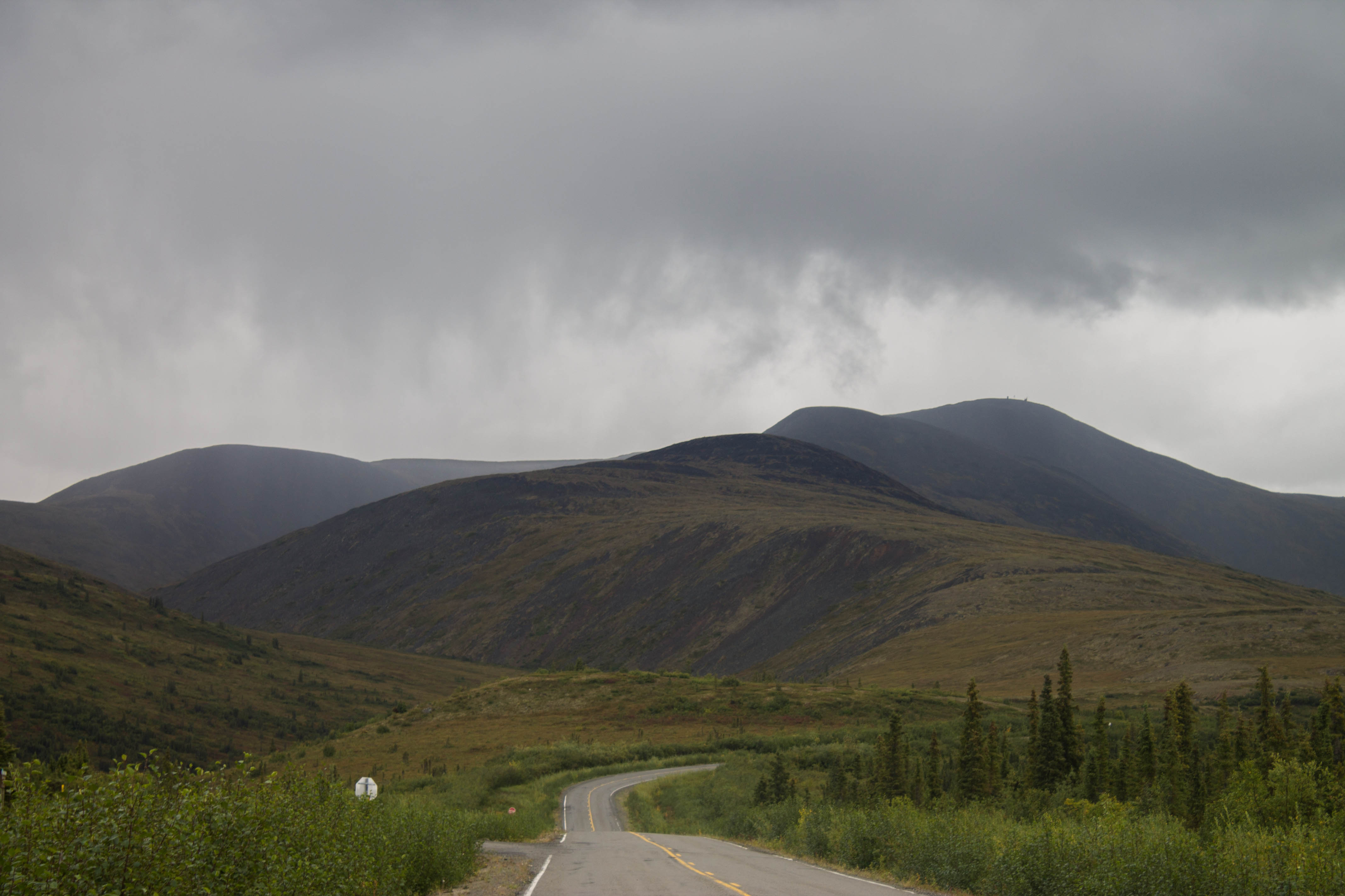
Back into Canada. See the end of the pavement ahead? Apparently, this highway had been surfaced in chipseal at one point, probably when it was initially constructed, around 1955.
I met three cyclists almost immediately after crossing back into Canada, but the weather was still quite cold and rain was not far off, so conversations never lasted long.
The TotW Highway was an incredibly challenging yet memorable experience. The highway curved around hilltop after hilltop, revealing expansive vistas to the north, south, and sometimes both at the same time. Frequently, I could make out the thin, unpaved road snaking its way along impossibly distant features. The perspective was so foreign that I often saw hills so far into the distance that their grades appeared impossible to climb due the perspective compression. It was a little unnerving, but they usually turned out to be quite manageable.
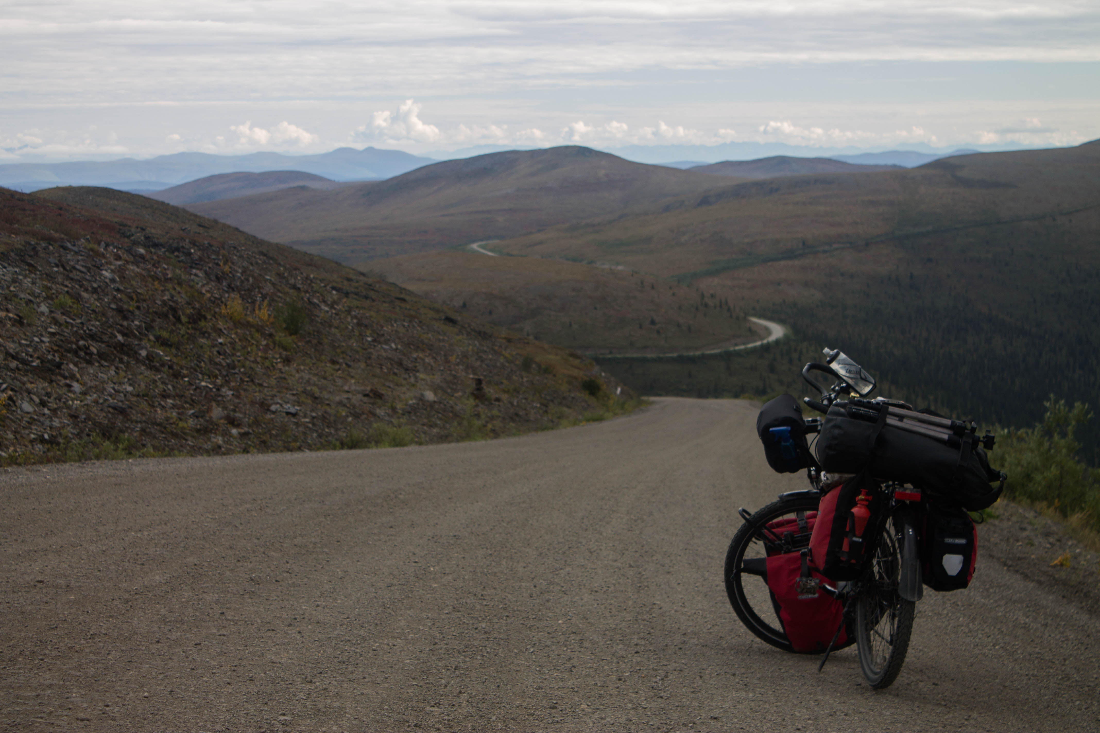
Thrilling corners along the TotW Highway.
Near the halfway point of the day, I summited a completely ridiculous hill, well over 10% and covered in loose gravel. My cadence dropped into the single digits as I mentally grouped pedal rotations in the hundreds to cope with the punishment. After reaching the top, I rolled my haggard body to a nearby rest stop (brutal hills always seem to have some reward out here), stuffed my face with about 2000 calories and collapsed for a spell. Several RVs were nearby, and the silence that had been with me for much of the day was unfortunately occupied by diesel generators.
The caravan soon headed on, and I knew that I had to as well. Luckily, I was through the steepest hills, but the road was never truly flat, as the many cyclists I’d passed had foretold. The weather had also improved significantly, and I was feeling much more confident than earlier about making it to Dawson City.

Looking north. The mountains visible in the distance form the southwest border of the Ogilvie Mountain Range, which gradually curves to the east as it comes down from the Arctic. The Tombstone Territorial Park, along the Dempster Highway, resides within this range.

Are we there yet? Tuckered out yet happy.
After hours of plodding on, one kilometer marker to the next, I reached the final 14km descent into Dawson City. Pavement soon appeared again, and what a gift it was! I had to catch a free ferry across the Yukon River before entering Dawson City proper, quite a piece of work itself, literally ramming into the riverbank to facilitate loading and unloading. The Yukon moved at an impressive speed, and watching the ferry navigate the current effortlessly was quite entertaining. I was reminded of high school math problems involving relative velocity.

The beginnings of a long sunset.

A sight for sore eyes (and legs).
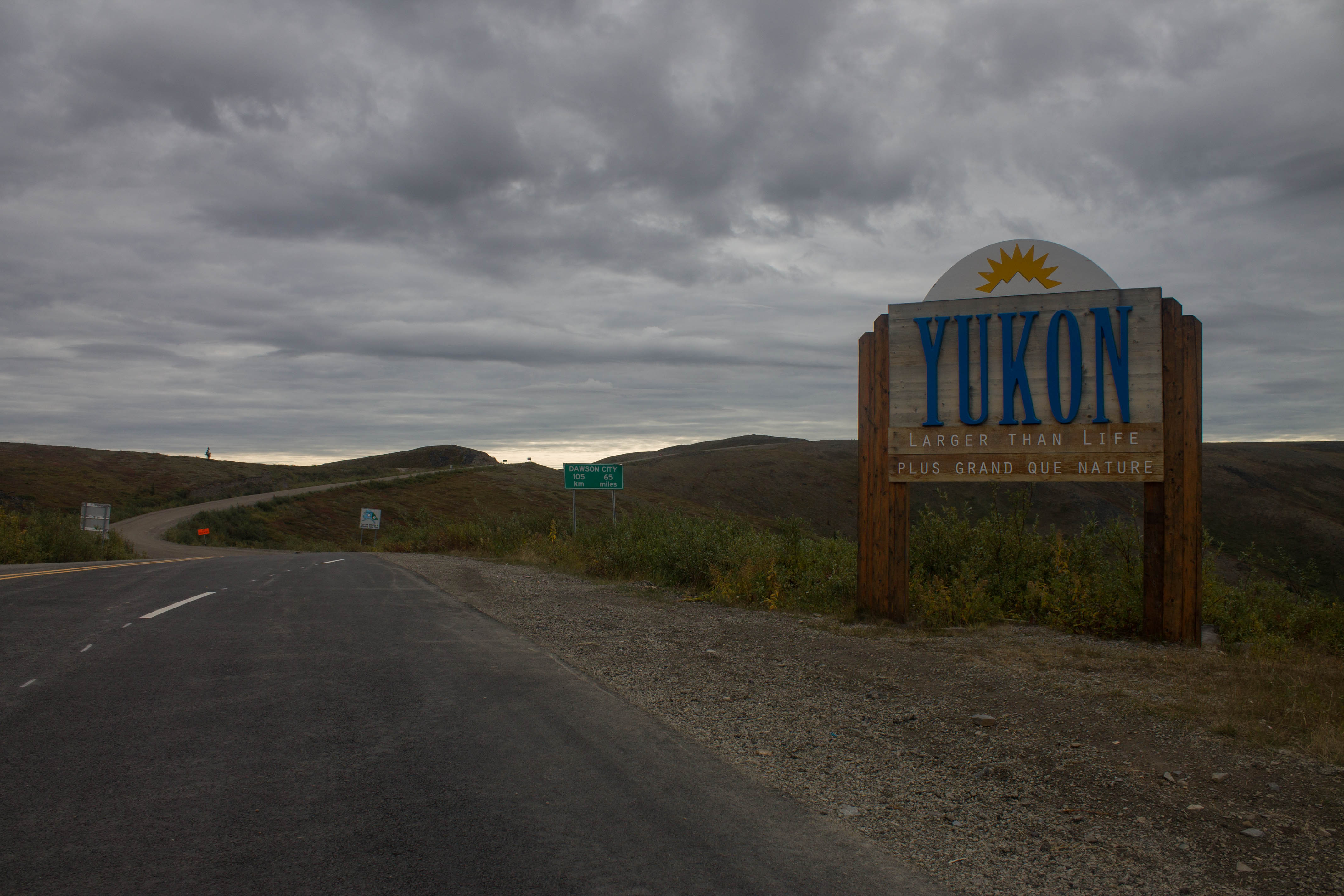
Finally in Dawson, I felt like I had stepped into the past. This place felt authentically like everything that Skagway was trying to be. There were no false fronts here. Everything was completely charming and attractively rugged, with only one paved road through the town.

Dawson City limits.

Looking down the main drag.
I had dinner with a friend whom I had met on the Taylor Highway two days earlier, and while we were scarfing down some excellent food, the rain started coming down in buckets commanding the attention of everyone inside. Locals told me that this constant rain was highly atypical for what is normally an arid climate.
I ended up hanging around the tourism centre for its wifi hotspot so long that I missed the business hours of a highly recommended nearby hostel. Luckily, my friend had a campsite in the nearby campground that he had offered to share, so I scooted over and set up my gear in the pitch black nearly on autopilot. It was time for a couple of days off, the first since leaving Whitehorse almost two weeks earlier.
